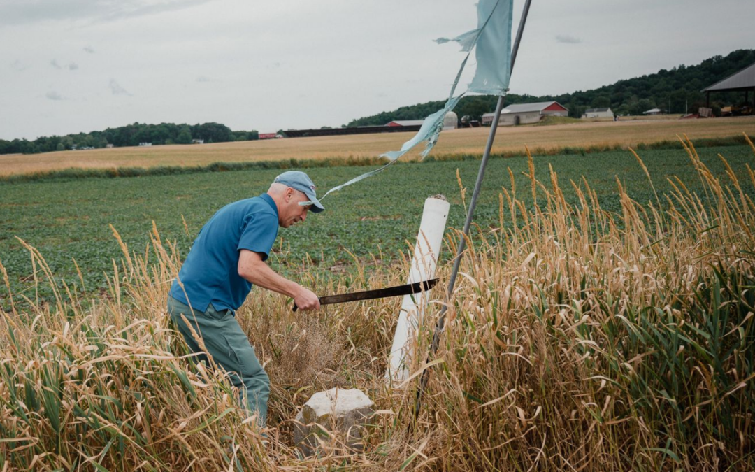
I can no longer see Wayne Aubertin, but I can still hear him: his legs thwacking through the underbrush, his labored breath. “Come on!” he yells at no one in particular.
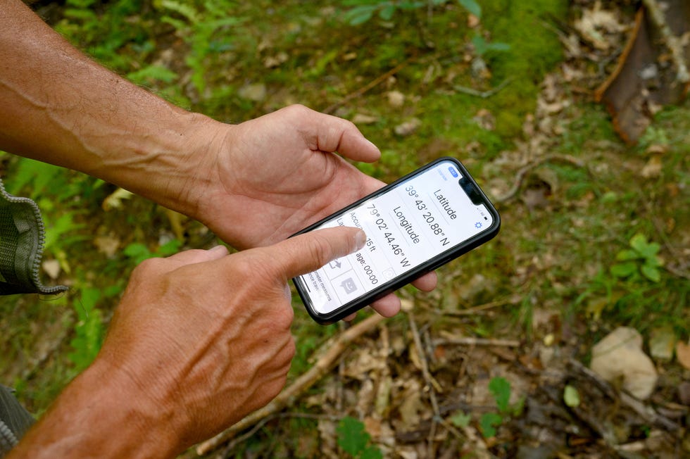
A few minutes later I emerge into a clearing of young saplings and find the 58-year-old surveyor cross-legged in the leaves, folded over a stack of topographical maps streaked with pink highlighter. The phone in his hand is displaying coordinates down to the second in bold, blocky typeface. “We’ve gotta be within 80 feet,” he says.
It’s a brilliant May afternoon in the woods of western Maryland, and Aubertin is tantalizingly close to finding a stone the size of a shoebox, last seen, according to a 70-year-old report somewhere in that pile of maps, “in a thicket on a rocky hillside.” This task would be easier, no doubt, if we weren’t in a geographic region that’s almost exclusively thickets and rocky hillsides.
Aubertin had been catching a nap in his truck when I met him a few hours earlier in the parking lot of a budget hotel, rousing quickly and greeting me with the wide smile and enthusiasm of a camp counselor. “I brought a gift for you,” he beamed, presenting me with a tennis-ball-yellow shirt and vest, my surveyor’s outfit for the day. Aubertin may be a congenial host, but he’s a serious surveyor. During his four decades in the business, he’s surveyed the Washington Aqueduct and the grounds of the White House twice.
As Aubertin rechecks his calculations, sweat dripping from the bill of his cap, I imagine the men who first marked this place on the map more than 250 years ago. Charles Mason and Jeremiah Dixon spent four grueling years doing what we were doing now: clambering up mountains, cursing under their breath, wondering if what they had set out to do was even possible. No one in North America had ever traced a line of latitude as it curled around the earth, but the border feud between Pennsylvania and Maryland had gone on so long and gotten so bloody, there was nothing left to do but try.

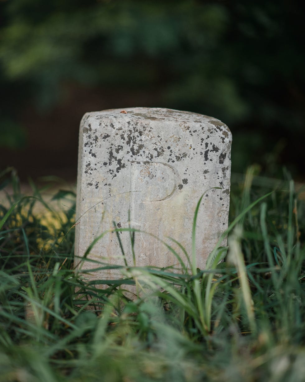
So they followed the stars across the wild and tangled land, through bitter winters and brutal summers, towing wagons of specially made equipment behind them and marking each hard-earned mile with a 500-pound limestone monument quarried and carved (P for Pennsylvania on one side, M for Maryland on the other) in England. Incredibly, Mason and Dixon were successful. The 233-mile line they drew was often accurate to within 100 feet. It was, one historian said, the 18th-century equivalent of putting a man on the moon.
That’s why, to people like Aubertin at least, the stones are more than an interstate border; they’re a testament to one of the most important scientific accomplishments in our nation’s history.
But in the intervening three centuries, as the line came to represent a metaphoric boundary more than a physical one, the stones, which lacked any meaningful government protection, languished. Nicked by tractors, knocked over by snowplows, stolen by bored locals. Today, few people outside the region know the Mason-Dixon Line is a tangible boundary; fewer still appreciate the technological triumph it represents.
So volunteer surveyors like Aubertin, working at the behest of the Maryland Geological Survey, have spent the last few years finding and cataloguing all 226 remaining stones (the vast majority of which are located on remote private properties). They hope that securing them a spot on the National Register of Historic Places will finally safeguard them—and celebrate one of the most important scientific feats in early American history.
Satisfied we’re in the right place, Aubertin and I spread out and resume our trudge up the mountain. Just when I think our own expedition might be a flop, I look to my right and there it is: mossy and listing, its chiseled ‘P’ still perfectly legible. A monument to man’s ingenuity and fortitude, half-buried in dead leaves.
n 1730, 162 miles due west from where Aubertin and I were inspecting the rock, a man named Thomas Cresap launched an aggressive campaign to rid Maryland of squatting Pennsylvanians. He built an imposing fortification on the Susquehanna River, claimed and sold land he didn’t own, and terrorized both Native Americans and immigrant settlers alike; they called him “the Maryland Monster.”
During the eight-year Cresap’s War, as it came to be known, armed gangs and colonial militias took turns storming the disputed border, exchanging threats and the occasional gunshot. When Cresap was finally apprehended and taken to Philadelphia for trial, he couldn’t resist a final provocation. “This is one of the prettiest towns in Maryland,” he purportedly told his captors.
He wasn’t exactly wrong.
When King James I of England granted the land that would become Maryland to Cecil Calvert in 1632, the new colony was to be bounded on the north by the 40th parallel of latitude. Almost fifty years later, when William Penn received the land between New York and Maryland, Pennsylvania’s southern border was also set along the 40th parallel of latitude. The charters for both colonies referenced a 1608 map based on John Smith’s survey of the Chesapeake Bay region.
There was just one small problem. It was a bad map. In reality, the 40th parallel actually fell somewhere north of Philadelphia, placing the booming settlement in Maryland.
To remedy the situation, William Penn commissioned his own map, which placed the 40th parallel much farther south. So far south, in fact, his colony contained not only Philadelphia but also Baltimore—and the mouth of the economically vital Chesapeake Bay.
For half a century, the proprietors of each colony authorized land grants “according to their perceptions of the line’s location,” writes historian and author Sally M. Walker in her book Boundaries: How the Mason-Dixon Line Settled a Family Feud and Divided a Nation. Meanwhile, settlers near the disputed boundary struggled to figure out whose laws to follow, who they owed taxes to, which colony to pledge their allegiance to. “The stage was set for some spectacular feuds,” Walker writes.
When King George II heard about Cresap’s feud, he scolded his colonial governors, ordering them to knock off the “tumults, riots, and other outrageous disorders on the border.” He instructed them to appoint surveyors and nail down an official border once and for all.
After several decades and several failed surveys, the Calverts and Penns turned to the experts. On November 15, 1763, Charles Mason, a renowned astronomer from Britain’s Royal Observatory, and Jeremiah Dixon, a fellow astronomer and respected land surveyor, arrived in Philadelphia. The two men had recently dazzled the scientific world by successfully observing the Transit of Venus from an observatory on the Cape of Good Hope, a feat that would help astronomers measure the size of the solar system. Now, the pair turned their attention to their next historic collaboration: the first geodetic survey ever conducted in North America.
Prior to Mason’s and Dixon’s arrival in the New World, borders were drawn using landmarks like rivers or mountain ridges, or with a technique called plane surveying, which treats the surface of the Earth as a flat plane. It works well enough for property boundaries, but walk in a straight line long enough and the curvature of the planet will soon begin to alter your trajectory.
A geodetic survey, however, accounts for the roughly spherical shape of the Earth, and required (long before calculators and computers) an understanding of astronomy and geometry—not to mention the most accurate and expensive instruments of the day.
By the time Mason and Dixon got to work, officials from Maryland and Pennsylvania had finally agreed that the border between the two colonies should run along whatever latitude was 15 miles south of Philadelphia. In the backyard of the Plumstead-Huddle House, at the time the southernmost point in the City of Brotherly Love, the men convened a surveying crew, set up a makeshift observatory, and embarked on a routine they would repeat countless times during their journey.
First, they needed to figure out precisely where they were. This job belonged mostly to the 35-year-old Mason, who spent long nights lying beneath the zenith sector—a six-foot, vertically mounted telescope so delicate it had to be transported on a feather bed. The astronomer used the instrument to measure the zenith distance, an angle created between a star’s position in the sky, the observer, and the point in the sky directly above the observer, the zenith.
To make sure his telescope was pointing directly overhead, Mason would observe a single star as it crossed the perpendicular lines that met in the center of his viewfinder. If the star crossed the vertical line exactly halfway between the two times it crossed the horizontal line, Mason could be sure his instrument was aimed at the zenith. Timing the stars required a clock as tall as he was, one that reliably counted seconds, and which could also be hauled across the rugged landscape.
Once Mason had calculated the zenith distance, he could look up its declination (the celestial equivalent of latitude) in a star table and use the two values to calculate his own latitude on earth.
With latitude established, the team could begin their slow march down the meridian. Blessed with better working hours, 30-year-old Dixon spent his days at the helm of his circumferentor—an instrument used to measure direction and horizontal angles on land. The predecessor to a modern surveyor’s theodolite, a circumferentor contained a large, horizontal compass with two upright sightings, through which Dixon would peer at a crewman several hundred feet away, signaling him to move right or left until he was perfectly centered. The crewman then drove a stake in the ground and more crewmembers connected the two points using a Gunter’s chain, a 66-foot-long chain made up of 100 links. Still more crewmen were needed to fell trees and carry the equipment.
In early April 1764, more than a month after they got started in Philadelphia, the group arrived in a soggy farm field belonging to one Alexander Bryan. More nights of stargazing and calculations revealed their latitude: 39°43’18.2”. It was the line that would officially separate Pennsylvania from Maryland. Here, they drove a wooden post into the ground, called it “the post marked west,” and marched into the unmapped wilderness.
“I Know What You’re Talking About and I Know Exactly Where It Is.”
The morning after our adventure bush-whacking around Grantsville, Maryland, I meet Aubertin at an IHOP off the interstate. Over a short stack and some sausage links, the veteran surveyor of 38 years recounts some of the many Mason Dixon stones he’s found. So far, he’s inventoried more than 70—over a quarter of the 226 monuments that mark the line.
“I’m boots on the ground, I’m shotgun, I’m get-them-done,” Aubertin says decisively, sawing off a bite of pancake. He makes it sound easy, but “getting them done” has required miles of walking and hours of small talk. In the three-plus years he’s been volunteering on the project, Aubertin has knocked on hundreds of doors, chatting up everyone from generational landowners to half-naked and hungover renters, many of whom could provide only vague directions to the historical oddity on their property. In the days we spend together, Aubertin finds stones along gas lines, next to ATV trails, obscured by the detritus of old logging operations, and perched atop seriously steep mountains. At each one we gather the measurements, notes, and photos the National Park Service will need to decide whether or not to approve the stones’ addition to the National Register.
Aubertin says that on his long jaunts through the western Maryland countryside, Mason and Dixon are never far from his thoughts, that all surveyors spend their career walking in another surveyor’s footsteps. This seems like a nice bit of professional camaraderie, but Aubertin is quick to clarify—the ghosts of surveyors past aren’t always the benevolent kind.
In other words, a surveyor’s error—his inaccurate coordinates, say—can trigger a chain reaction of mistakes, not just across a physical space, but across time, too, sabotaging surveys for years into the future.
So Aubertin approaches each stone with the eye of a detective. State tax rolls allow him to ascertain the property lines he’ll need to cross and the last names of the folks he’ll encounter. Notes taken during various resurveys of the line also help. In 1902, for example, the states of Pennsylvania and Maryland replaced the rock cairns Mason and Dixon set for mile markers west of the Allegheny Mountains (where the severe topography made transporting limestone monuments virtually impossible) with replicas of the ones found in the east.
Aubertin and I decide to spend the morning tackling one of the biggest mysteries on the line. He pulls out yet another bulging folder of maps and typewritten reports and spreads them across the syrup-sticky table before us.
In 1767, Mason’s and Dixon’s survey party arrived at the Youghiogheny River, almost 200 miles from the “post marked west,” and built a tower of rocks they gathered from its banks. In 1902, the cairn was replaced with a replica stone, which, 40 years later, was saved from a watery grave by the Army Corps of Engineers during the construction of an upstream hydroelectric dam. The last time anyone had laid eyes on the stone was in 1953, on a farm “some distance north of the boundary,” according to an undated Maryland Geological Society report, which was stapled to a final clue: a circle drawn in pencil on a photocopied map of Polk Hill, Pennsylvania, the word “Glover” written next to it in all caps.
Polk Hill turns out to be a tiny hamlet of maybe a dozen or so residents, all of whom seem to be spending their Sunday morning outside, weeding flowerbeds, washing cars, or smoking a cigarette on the porch. The first person Aubertin approaches tells us his name is, no kidding, Mike Glover.
“I know exactly what you’re talking about, and I know exactly where it is,” Glover says, as the hair on my arms stands up. He directs us to a state route a couple miles away. “You’ll see a grocery store, then a parking lot. I’m thinking it’s the first house beside that lot. It’s been sitting next to that driveway for decades.”
Ten minutes later, we’re pulling into the driveway of the first house after the parking lot next to the grocery store. It’s a tidy, moss-green split-level, and Aubertin’s truck isn’t even in park before his face cracks into a grin. “I’m going to let you find it,” he says. It takes a second before I see what he sees: the 1902 replica stone planted right next to the woodshed. We snap a celebratory selfie with the old rock before Aubertin begins documenting its condition.
We’re about to leave when the owner of the house returns home. A bald man wearing boat shoes steps out of his car looking a little wary to find strangers with clipboards on his property. But when we tell him we’re here about the stone, suddenly we’re as good as invited guests.
The man is Terry Grove, and it was his “grandpaps,” both of them, who brought the stone here sometime in the 1960s. “They were on a crew, working on grading this road,” he explains, pointing to the busy street behind us. “Machinery caught it, knocked it over the bank.” The foreman told the men to keep working, but later, under the cover of nightfall, they returned to rescue the monument.
Grove, who grew up using the stone as his personal jungle gym, says that over the years his parents turned down frequent offers to buy it. When he inherited the home—and by default, the stone—he moved it next to the woodshed, a spot where it could be safe and relatively unseen. “I want to keep it looking nice,” he says, “and it was a pain to mow around.”
Finding a stone that had been lost for 70 years required half a breezy morning, conversations with a few friendly strangers, and the reliable guidance of Google Maps. Compared to Mason and Dixon, Aubertin had it easy. Their survey took place amidst the vigilante justice and violent uprisings of Colonial America, through an unforgiving terrain still teeming with predators. In July 1767, when Charles Mason looked out over the same bucolic land we admired from Terry Groves’s backyard, he saw “a wild waste, composed of laurel swamps, dark vales of Pine through which I believe the Sun’s rays never penetrated.”
Drawing the line through that wild waste required help. A lot of it. During its four years afield, the survey party swelled to as many as 115 workers—including axmen, cooks, packhorse drivers, tent keepers, and instrument bearers—as well as a herd of cows and its attendant shepherd, milkmaid, and butcher. This motley bunch plodded forward six days a week, from sunup to sundown, pausing only for an afternoon meal of cold meat and beer. Evenings were spent making or maintaining camp, cooking over the fire, and keeping watch for bears or wolves, as the English surveyors stole away to their tents to clock the stars, to check their numbers, to make sure their line was still true.
Progress was slow and halting, and constantly hindered by weather. (“Fogs and mist so thick that we could not proceed,” reads one entry from Mason’s journal. “Snow still so deep we could not proceed,” goes another.) And yet more territory disputes. For much of a year, the party lingered as Colonial officials negotiated access with the Six Nations, the Indigenous tribes who had lived in and warred over this mountainous land generations before the surveyors arrived. Finally, in July 1767, eleven members of the Mohawk tribe and three from the Onondaga tribe joined the survey party to serve as paid escorts to the farthest reaches of William Penn’s royal charter.
But just a few months later, the effort finally began to fracture, after two packhorse drivers were crushed to death by a felled tree and the Indigenous escorts grew uneasy about crossing boundaries of their own. In October 1767, when the party reached the Catawba War Path, 30 miles east of what is now Pennsylvania’s southwest corner, one of the Six Nations chiefs declared he “would not proceed one step farther westward,” according to Mason’s journal.
At 233 miles, 17 chains, and 48 links from “the post marked west” in Mr. Bryan’s field, the men turned around. “Thus ends my restless progress in America,” Mason wrote soon after. (In 1784, astronomers David Rittenhouse and Andrew Ellicott would finally extend the line to its terminus—5 degrees west of the Delaware River.)
The surveyors were paid about 3,000 pounds for almost five years of work—about $372,134 apiece today. Both returned to England, and both died in relative obscurity in the decades that followed. It’s unlikely either ever heard their project called the Mason-Dixon Line; the 1768 report on the survey doesn’t even mention their names.
In fact, most Americans didn’t associate the interstate border with the pair until just over 50 years later, when the Missouri Compromise banned slavery north of “Mason and Dixon’s line,” and sliced the country into ideological halves. (The compromise is also the reason many Americans wrongly believe the line extends deep into the Midwest.) Suddenly, the border between Maryland and Pennsylvania didn’t simply mean the difference between two states, but two states of being. “When I found I had crossed that line, I looked at my hands to see if I was the same person,” Harriet Tubman famously said.
The Civil War and subsequent Civil Rights struggle may have etched the symbolic line into the national psyche, but the literal line has spent the last two centuries crumbling. Neither Maryland nor Pennsylvania seemed to have the funding, staff, or interest in caring for hundreds of far-flung rocks.
Into that vacuum stepped the surveying community, who have always viewed the line as the crowning achievement of their profession. In 1990, a few dozen of them formed a nonprofit called the Mason-Dixon Line Preservation Project, with a mission to repair, replace, and otherwise tend to these historic artifacts. After a few decades of thankless volunteer work, many MDLPP volunteers have stepped up to help the MGS with its stab at the National Register, which would require the first, full inventory of the stones in more than 50 years, something the state didn’t have budget for.
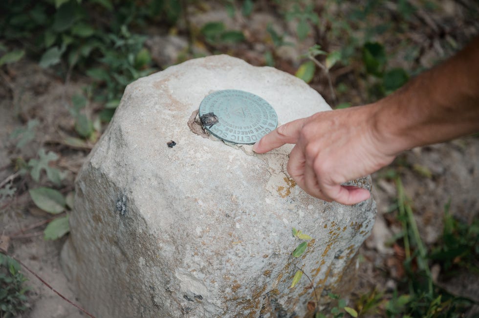
A spot on the Register would designate the stones as worthy of preservation and make them eligible for a slew of grants and tax credits (including the federal government’s Save America’s Treasures program, which has awarded more than $300 million to historically significant artifacts like the Gettysburg Cyclorama, the 1905 Wright Flyer, and the Saturn V rocket), money that would come in handy when a stone needs to be repaired, replaced, or protected.
Chris Connallon, who helped get the project off the ground in 2019 while he still worked for the Maryland Geological Survey (today he takes part remotely from his home in New York), says that if the stones make it, he hopes both states will receive federal funding to maintain the centuries-old monuments, but perhaps more important, to tell the story of how they got there in the first place.
“We’re not just talking about the stones,” he says. “We’re talking about the preservation of a historic event, which took a historic effort. The stones are just the physical representation of that effort.”
As the project’s dataflow manager, Connallon has been on the receiving end of the surveyors’ reports and photos from the field, like the ones Aubertin gathered in western Maryland, giving him a unique view of the staggering amount of time that has gone into the inventory. “I wish I could calculate how many hours these surveyors have donated to the states and, really, to the country.”
Connallon can appreciate how personal this project is for many of them. “I once had an old archeologist tell me that every artifact tells a story, and when you find it, you’re also part of that story,” Connallon says. “It’s real hokey. But it’s also kind of true.”
“Beyond Comprehension”
A few weeks after my adventures with Aubertin, I meet up with Pennsylvania surveyor Eric Gladhill to visit some stones outside of Gettysburg. Gladhill, who inventoried 19 stones for the National Register application and served as the project liaison to the Pennsylvania Society of Land Surveyors, grew up within walking distance from the line; on childhood hunting trips, his dad used Mason’s and Dixon’s monuments to know where they could and couldn’t shoot.
Gladhill has been a surveyor for 44 years and seems to consider the job more of a spiritual pursuit than mere occupation. His self-published memoir, cleverly entitled Finding My Boundaries, describes how his professional development as a surveyor facilitated his moral growth as a human. It wasn’t just industry mentors or encouraging colleagues that reformed the art school dropout, but the many years spent outside, searching for something, and relying on strong legs and sharp analytical skills to find it.
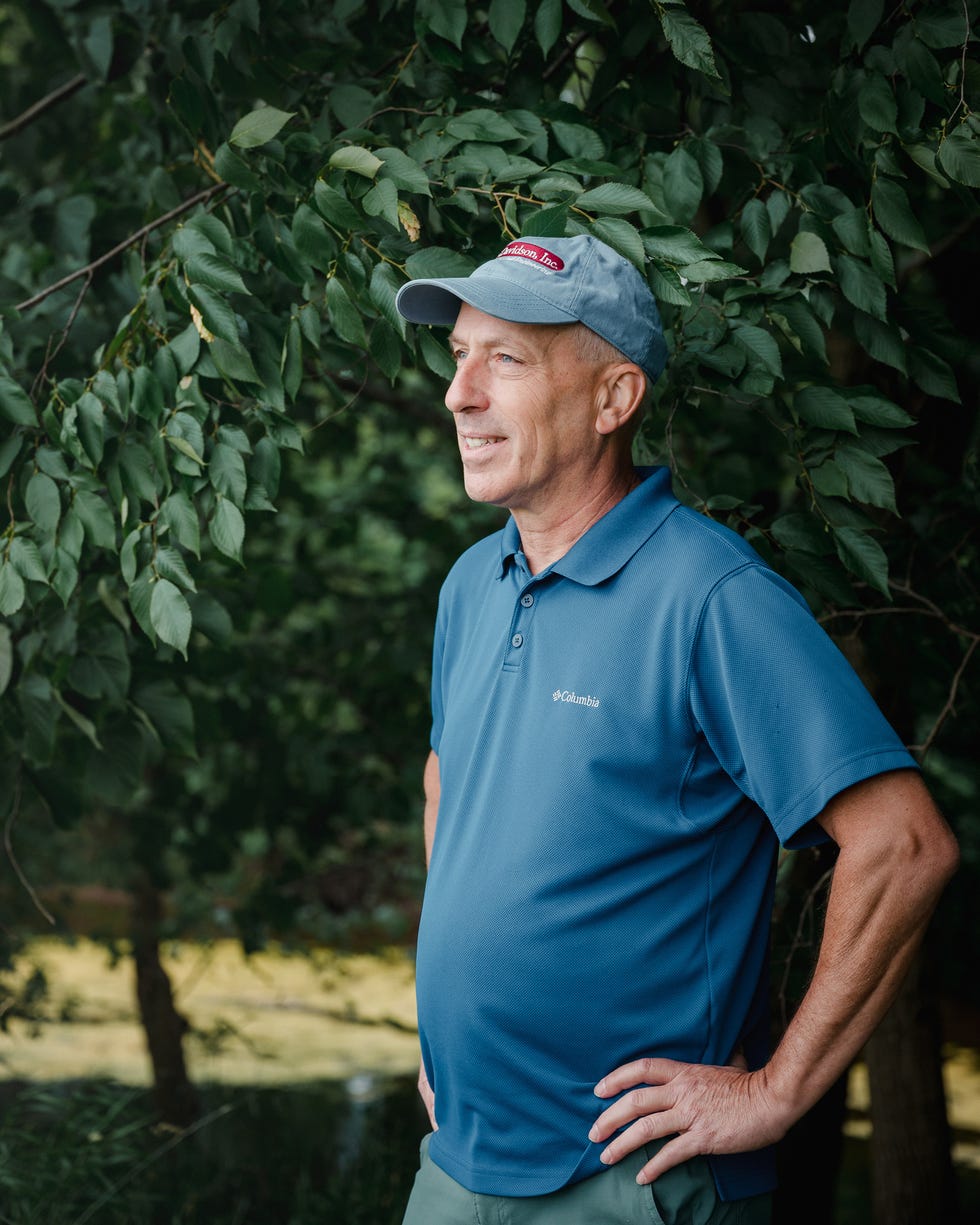
Despite a lifetime on the line and a career in the field—or perhaps because of it—Gladhill still finds himself in awe of Mason and Dixon. “If you truly know and can understand what they did, it’s beyond comprehension,” he says. “Even now when I sit down and look at their calculations, it’s way over my head.”
The east side of the Mason-Dixon Line runs through less mountainous, more populous territory, and so the stones—the original monuments set by the 1764 survey party—are often located in incongruously modern places.
One of the stones Gladhill takes me to see resides behind the Mary-Penn B&B, where the upstairs bathroom is divided between two states, with a toilet in Maryland and a shower in Pennsylvania. At another house, we find a stone festooned with plastic pirate swords, the remains of a rousing game of make-believe. Ten minutes away, at Mason-Dixon Farms on Mason-Dixon Road, a stone sits within smelling distance of a crowded corral of cows. The last stone we visit lies beside a bunch of black-eyed Susan in a backyard flowerbed. A Colonial relic, 10 feet from the propane grill.
Their pyramidal tops had been rounded by centuries of snow and rain, but all of the stones were remarkably readable; I could imagine the surveyors blowing dust from a corner of the M, tracing their finger along the curve of the P.
Gladhill says he meets people all the time—even in an area speckled with stones and landmarks named after the surveyors themselves—who don’t know Mason and Dixon were real people. He recently taught his barber, a 50-year-old Gettysburg native, about the stones that mark the line.
Not long after our afternoon together, Gladhill emails to say the inventory was complete. Altogether, 30 volunteers spent more than three years tracking down 218 stones scattered along the border of Pennsylvania and Maryland.
When I text Aubertin to see what it feels like to be finished, he responds that he’s toggling back and forth between “great satisfaction” and “a feeling of ‘what now?’”
Except there is still a little work to be done. Two of the eight missing stones were ones Aubertin looked for in western Maryland, probably hidden, he guesses, beneath dense groundcover. One stone hasn’t been seen in 90 years, the other is nowhere to be found despite pink surveyor’s tape crisscrossing the woods where it should be. Even though the Maryland Geological Survey’s project is complete, he plans to keep looking.
“I don’t think summertime was the best time to do it,” Aubertin writes. “I’ll be giving it another go in the early winter.”
It seems the surveyor is a part of the 400-year-old story now, and he’s not quite ready for it to end.
–popularmechanics.com

